Sunday, May 18, 2003
I did another SaddleSore 1000 yesterday. Up to the Bay area and
back. A total of 1,039 miles this time.
I left at 3:12 in the morning on Saturday. I needed to pad a few extra
miles to put me over 1,000 - so both going up and back, I didn't take I-5 between
Sylmar and Tejon Pass, instead I went up CA-14 to Lancaster and then took CA-138
to Gorman. This added about 40 miles each way. I had to get gas in
Sylmar to mark my starting time, and then gas again in Lancaster to prove I was
there. The full moon was getting ready to set as I was going west on
CA-138. Next stops were in Buttonwillow and in the town of Coalinga, along
CA-198. It was 6:30 when I got to Coalinga and the sun was over the
mountain to the east. I changed to my tinted shield.
I bought some meat, cheese, and crackers for breakfast. I decided that
a picnic in the mountains would be better than the Quickie Stop parking lot, so I
continued west on CA-198 and then north onto CA-25. Both of these roads
were fun, a nice mix of twists and straights. (for more on great
California roads see the pashnit
site.) A short jog west on CA-146 put me at Pinnacles NM.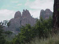 I zipped up to the entrance booth, whipped out the parks pass, and gave it to
the ranger. We chatted a bit. Finally he asked "Doing some
hiking today?" "No," I answered, "I'm taking a break
from riding by stopping at the Visitor Center." "You'll have a
long break," he replied. "The VC doesn't open until
9." Oops. I should have checked the times on the NPS site
before I left. Could've slept in for another hour, since it was just past
8. I continued up to the VC, and enjoyed a leisurely breakfast in a nice
quiet canyon. Some more hiker were straggling in to start their day.
The VC opened right at 9, and I was on my way shortly after, 300 miles down, 740
to go!
I zipped up to the entrance booth, whipped out the parks pass, and gave it to
the ranger. We chatted a bit. Finally he asked "Doing some
hiking today?" "No," I answered, "I'm taking a break
from riding by stopping at the Visitor Center." "You'll have a
long break," he replied. "The VC doesn't open until
9." Oops. I should have checked the times on the NPS site
before I left. Could've slept in for another hour, since it was just past
8. I continued up to the VC, and enjoyed a leisurely breakfast in a nice
quiet canyon. Some more hiker were straggling in to start their day.
The VC opened right at 9, and I was on my way shortly after, 300 miles down, 740
to go!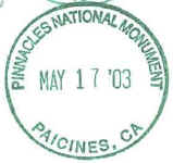 The Pinnacles are leftovers from a volcano's core. Actually, only half of
the volcano. This particular volcano had the misfortune of being right on
the San Andreas fault. This is a strike-slip fault were the west side is
moving north. The other half are by Neenach, 195 miles away.
Interestingly, I had passed through Neenach earlier that morning (it's along
CA-138, about 12 miles east of I-5). It was shaping up to be a San Andreas
weekend. CA-138 traveled up the rift zone, CA-25 is also directly on top
of the fault, and I would be traveling I-280 up the fault zone, and my last stop
for stamps, Point Reyes NS is also right on the fault zone. As I was
leaving the NM, I was glad that I came early when I passed the toll booth.
There was a line of 5 cars waiting to get in!
The Pinnacles are leftovers from a volcano's core. Actually, only half of
the volcano. This particular volcano had the misfortune of being right on
the San Andreas fault. This is a strike-slip fault were the west side is
moving north. The other half are by Neenach, 195 miles away.
Interestingly, I had passed through Neenach earlier that morning (it's along
CA-138, about 12 miles east of I-5). It was shaping up to be a San Andreas
weekend. CA-138 traveled up the rift zone, CA-25 is also directly on top
of the fault, and I would be traveling I-280 up the fault zone, and my last stop
for stamps, Point Reyes NS is also right on the fault zone. As I was
leaving the NM, I was glad that I came early when I passed the toll booth.
There was a line of 5 cars waiting to get in!
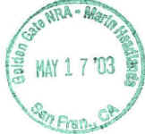
Gas at Gilroy, along US-101, then CA-85, I-280, and then CA-35 to the
coast. Just inside of the city limits of San Francisco I stopped at Fort
Funston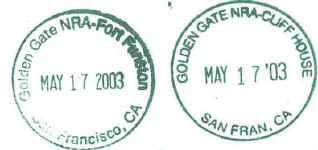 ,
one of several ex-military bases that guarded the Golden Gate. All of
these are now part of the Golden Gate NRA. Since the Cliff House was
being remodeled, the stamp for it was here, also. There also is a stamp
series for lighthouses, but I was running out of room in the green section of
the passport book, so I only got 2 that I liked among all that were available at
my many stops this day. I continued north along the coast for 5 miles and
stopped at the Cliff House for a quick look around. Then it was another 5
miles to the Presidio
,
one of several ex-military bases that guarded the Golden Gate. All of
these are now part of the Golden Gate NRA. Since the Cliff House was
being remodeled, the stamp for it was here, also. There also is a stamp
series for lighthouses, but I was running out of room in the green section of
the passport book, so I only got 2 that I liked among all that were available at
my many stops this day. I continued north along the coast for 5 miles and
stopped at the Cliff House for a quick look around. Then it was another 5
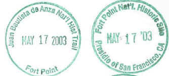
miles to the Presidio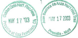 for another GG NRA stamp, and a Juan Bautista de Anza NHT stamp. Earlier,
I had traveled along some of the roadways that are marked for the de Anza scenic
Trail. The main visitor center is being remodeled, so it was temporarily
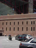
in the dining hall. I then went another mile and a half to get to Fort
Point. This fort is right under the Golden Gate Bridge. The fort is
made of brick. It was built just before the Civil War, and was designed
for 126 massive cannon. Advances in cannon design made brick forts
obsolete and it was abandoned for that use by the late 1880's. I took a
picture of the fort and the Golden Gate Bridge support. The bridge is
being renovated, so the metal arch was built to protect the fort from thing
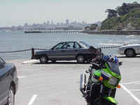
dropping. I also took a picture looking at the SF skyline from the
fort. A JBdA NHT stamp was also here, along with a small stamp of the
fort.
for another GG NRA stamp, and a Juan Bautista de Anza NHT stamp. Earlier,
I had traveled along some of the roadways that are marked for the de Anza scenic
Trail. The main visitor center is being remodeled, so it was temporarily
in the dining hall. I then went another mile and a half to get to Fort
Point. This fort is right under the Golden Gate Bridge. The fort is
made of brick. It was built just before the Civil War, and was designed
for 126 massive cannon. Advances in cannon design made brick forts
obsolete and it was abandoned for that use by the late 1880's. I took a
picture of the fort and the Golden Gate Bridge support. The bridge is
being renovated, so the metal arch was built to protect the fort from thing
dropping. I also took a picture looking at the SF skyline from the
fort. A JBdA NHT stamp was also here, along with a small stamp of the
fort.

I made my way up and over the Golden Gate Bridge (it's free going North), and
got off at the first exit. I went under the freeway and headed east into
the Marin Headlands. I first made a small side trip out to Fort Chronkite
which was built in 1940 by the Army. A Nike base is also in the area, but
it currently is only briefly open during the week. The visitor center is
in a former church. 
 I
also picked up a stamp for the California Sesquicentennial (California is 150
years old as a state, it was founded in 1850). Lots of pedal bikes were on the
roads. I almost took one out when he had suddenly decided to turn left as
I was passing him. I exited via Bunker Road, which goes through a very
narrow tunnel. The NPS converted it from a two lane tunnel (if even that,
you couldn't fit 2 hummers side by side in the tunnel) to a one lane tunnel with
a bike path. A system of lights allow traffic through the tunnel at 5
minute intervals (for each way). A quick gas stop in Mill Valley (the
traffic here was the pits, thank goodness for lanesplitting). Then up CA-1
and then over the roads to Muir Woods NM
I
also picked up a stamp for the California Sesquicentennial (California is 150
years old as a state, it was founded in 1850). Lots of pedal bikes were on the
roads. I almost took one out when he had suddenly decided to turn left as
I was passing him. I exited via Bunker Road, which goes through a very
narrow tunnel. The NPS converted it from a two lane tunnel (if even that,
you couldn't fit 2 hummers side by side in the tunnel) to a one lane tunnel with
a bike path. A system of lights allow traffic through the tunnel at 5
minute intervals (for each way). A quick gas stop in Mill Valley (the
traffic here was the pits, thank goodness for lanesplitting). Then up CA-1
and then over the roads to Muir Woods NM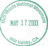
 .
Parking here is bad for the cagers. But there were some nice spots marked
motorcycle only. Parked right next to a pair of anniversary edition
Harleys, and went into the bookstore to get my stamp. Another GG NRA stamp
also was here. Muir Woods in a nice shady valley that you can walk
up. I wanted to go moving along, it was already after 1:45 and I had only
gone 465 miles. I used some aggressive riding techniques to get around
some people who couldn't drive, and got back out to CA-1.
.
Parking here is bad for the cagers. But there were some nice spots marked
motorcycle only. Parked right next to a pair of anniversary edition
Harleys, and went into the bookstore to get my stamp. Another GG NRA stamp
also was here. Muir Woods in a nice shady valley that you can walk
up. I wanted to go moving along, it was already after 1:45 and I had only
gone 465 miles. I used some aggressive riding techniques to get around
some people who couldn't drive, and got back out to CA-1.
CA-1 winds its way up the coast. I expect it to be slow and I soon did
catch up to a herd of cages. California has the curious habit of putting
an "END 35 SPEED LIMIT" when you get out of town, but there is no
"hey dummy, now you can go 55" sign. They assume that everyone
knows that the state speed limit on rural roads is 55MPH. Some bonehead
was putting down the road at 30-35 with at least 8 cars lined up behind
him. Again, in CA, when you are holding up 5 or more cars, you must use a
turnout and let everyone by. This driver was practicing being a float
driver for the Rose Parade and just ignoring those turnouts. After picking
off the other cars one by one, I displayed good hooligan riding techniques when
I passed him (at 55MPH in a nice straight spot) and gave the customary signal
indicating what I thought about his fine driving techniques. Now I wasn't
riding with my knees down or anything like that, in fact I didn't even exceed
55-60 for the next 50 or so miles along CA-1. And in one stretch I was
following a Jetta that I had caught up to at a stop sign in one of the many
small towns, and he was moving at the same brisk pace that I was. So I
wasn't going doing anything that 90% of the cars could do. Now I guess
I'll get off of my soapbox and continue with the trip report.
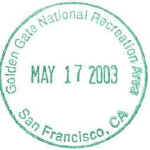
I stopped at Point Reyes NS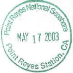 .
The visitor center is about 1/2 mile off of CA-1. CA-1 continues along
Tomales Bay, which was formed by the San Andreas fault. The fault zone can
be about 1 mile wide and the rocks in the zone are crushed and softened up by
the plates moving past each other. This causes "rift valleys" to
form, and at the shore of the Pacific Ocean, Tomales Bay occupies one of the
many rift valleys along the fault. I finally stopped for lunch at 3:35 in
Valley Ford, at the half way point of my journey. I had a nice pastrami
and pepper jack on dark rye sandwich made at the Valley Ford Market. There
is the market, a liquor store, 2 Italian restaurants, a post office and 2 small
inns making up the entire town. I left at 4:00, got gas in Sebastopol to
prove I went that far north, then gas again in 8 miles in Santa Rosa to show I
took CA-12 instead of CA-116. Then I followed CA-12 through Sonoma and
finally hit I-80 east of Napa. Whew, freeway for almost all of the way
home, now - except for CA-138, but that is 55MPH straight desert 2 lane.
Gas again in Sacramento, mostly to prove I was there. Iron Butt rules
state that if you do a 'circle trip,' you must get receipts from the
corners. It was 6:20 and I had 410 miles to go, down I-5 to LA County.
.
The visitor center is about 1/2 mile off of CA-1. CA-1 continues along
Tomales Bay, which was formed by the San Andreas fault. The fault zone can
be about 1 mile wide and the rocks in the zone are crushed and softened up by
the plates moving past each other. This causes "rift valleys" to
form, and at the shore of the Pacific Ocean, Tomales Bay occupies one of the
many rift valleys along the fault. I finally stopped for lunch at 3:35 in
Valley Ford, at the half way point of my journey. I had a nice pastrami
and pepper jack on dark rye sandwich made at the Valley Ford Market. There
is the market, a liquor store, 2 Italian restaurants, a post office and 2 small
inns making up the entire town. I left at 4:00, got gas in Sebastopol to
prove I went that far north, then gas again in 8 miles in Santa Rosa to show I
took CA-12 instead of CA-116. Then I followed CA-12 through Sonoma and
finally hit I-80 east of Napa. Whew, freeway for almost all of the way
home, now - except for CA-138, but that is 55MPH straight desert 2 lane.
Gas again in Sacramento, mostly to prove I was there. Iron Butt rules
state that if you do a 'circle trip,' you must get receipts from the
corners. It was 6:20 and I had 410 miles to go, down I-5 to LA County.
Gas again along I-5 in Panoche Road (8:15, 775 miles done, 265 to go), along with a dipped ice cream at
Foster's Freeze. Then gas again at the Stockdale Highway exit (10:20, 890
miles done, 140 to go). Just
before midnight, I was again in Lancaster for a required gas stop, and finally at 12:44 I got to the gas
station in Sylmar. I was home at 12:52, 21 hours and 40 minutes after I
started.
Total time in the saddle was 16 hours and 29 minutes. Average speed
while moving was 63.0 MPH. If you count the time stopped, I did the day
at an average of 48 MPH. I got 35 mpg overall, consuming just under 30
gallons of fuel.
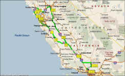 Click on map to see full size (101Kb). Microsoft
Streets & Trips File (200K). I also have the track
back log from the GPS, taken at 1 mile intervals (Garmin MapSource format)
Click on map to see full size (101Kb). Microsoft
Streets & Trips File (200K). I also have the track
back log from the GPS, taken at 1 mile intervals (Garmin MapSource format)
Total so far: