Day 3 - Globe, AZ to Sierra Vista, AZ
300 miles. 2 stamps.
I had originally planned to do Tonto NM as the first thing on day 3.
Since I already went there the day before, I could take it easy this
morning. I still wanted to make it to the museums at Fort Huachuca which
closed at 4, so I didn't dawdle too long. I finally was heading east out
of Globe at 7:45. It was 55 outside. Globe is at 3,500', so it was a
welcome change from the cold north. I had removed most of one layer of
clothing. I felt good to not be wearing so much.
I went east on US-70. Originally US-70 went all of the way to the
California coast, but from Globe westward it was co-signed with US-60. In
a move to simplify the numbers, US-70 was cut back to Globe. (See
this site for more detail on old US highways). US-60, which I had
traveled on the day before, does make it almost to CA. In CA US-60 was
replaced by I-10. US-70 drops (slowly) into the Gila River valley, and
then follows the river upstream. At Safford (elevation 3,000'), I again
met up with US-191 and turned south.
 US-191
south of I-40 all of the way to the Mexican border was originally US-666.
In 1992 ADOT had the number changed so it became an extension of US-191 (See
this site). After a bit, the highway met up with I-10 and turned
westward. I left I-10/US-191 in Willcox, heading south on AZ-186 to
Chiricahua (pronounced cheer-ri-cow-wa) National Monument. The road was
climbing in elevation, but it was fairly straight, crossing farm lands in a high
plain. I just traveling at a brisk pace, until I hit a few dips and rises
where I got some air under both tires. So I slowed it back down to a more
sedate pace.
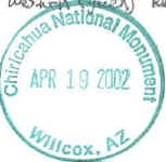
 I dug my National Parks Pass out at the entrance station and
then proceeded up Bonita Canyon about 2 miles to the Chiricahua National
Monument VC, which is at 5,400' in elevation. I got my stamp, and then
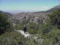
decided to continue 7 miles up the canyon to the road's end at Massai
Point. Massai Point, elevation 6,870', overlooks an area called the Heart
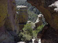
of Rocks which is Chiricahua's main feature. Ancient ash flows fused into
rhyolite tuff, which weathered and eroded into pillars. These pillars look
like an army of people. Some of them look like they are carefully balanced.
I walked on the trail that circles the overlook, and took the pictures that you
see on this page. Then it was time to head
back downhill. I left the Monument and continued south on AZ-181. I
reached US-191 again, but quickly left it to cut across the farm roads. I
reached AZ-80 and took it west towards Bisbee. I then continued west on
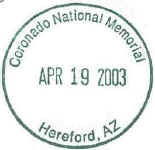
AZ-92. I stopped at
 Coronado
National Memorial. While I enjoy most of the
 National Parks, Monuments,
etc., I really had to question this one. It really seemed like a useless
park. Oh there was an ok VC with displays about Coronado, but overall it
was a bit of so what? I didn't go up the gravel road to the pass which
supposedly had a great view. I also still wanted to get to Fort Huachuca's
museum before they closed, so I left as quick as I could.
I got to the Motel 8 in Sierra Vista at 2:00. It was quite warm, so I
shed a layer of clothing and headed off for the base.
After checking in at the gate, I went to the museums, which were in 3
buildings.
Fort
Huachuca's museums were very good. If you are in the area, do stop
by. The fort (pronounced hwa-choo-ca) was the home of the Buffalo
Soldiers. It is now an Army Electronic Proving Ground where they tested
remote controlled surveillance drones. The Army Military Intelligence
Training Center is also there. I spent 1 1/2 hours at the museums.
Back to Day 2
On to Day 4