Day 21 - Friday, July 18, 2003
Carlsbad, NM to Globe, AZ
584 miles for the day, 8,634 miles traveled so far.
8:45 in the saddle, 11:15 total time check-out to check-in.
Average speed while riding was 66.6 mph.
Parks visited this day:
Stamps: 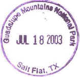
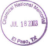
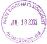
Daily Journal:
I left fairly early this morning, 7:15. I went south
on US-62, past Carlsbad Caverns, and on to Guadalupe Mountains NP, back in
Texas. I took all of these pictures there at the VC and at a former stage
stop which was just under a 1/2 mile walk from the VC.
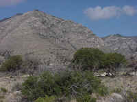
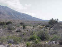
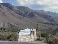
These mountains are mostly limestone, which is why there
are caves. They rise above the high plains. They are part of a
fossil ocean reef, formed about 250 million years ago.
US-62 drops drop to the lower desert as it leaves the
park. From here it was about 100 miles to El Paso. I had forgot to
get gas earlier, so I was a bit worried as I went west and there was hardly any
sign of civilization. I few places had a gas pump, but they looked so old
that I passed them up. When you only carry a few gallons, stale gas can
make a big difference. I still had my emergency spare 1/2 gallon under the
seat. I did manage to make it to the east edge of El Paso with about 1/2
gallon still in the tank.
I followed US-62 all of the way to the Mexican border and
Chamizal N Mem. I'm sorry, but this was another on my list of "why
did they bother to create this?" national parks. It turns out that in
the 1880's the Rio Grande (Rio Bravo in Mexico) took a path that was on the
north side of the park. Then channel improvements moved the river south,
but Mexico still wanted this land, which now had a dry channel as it's
border. Stone markers, which are still standing, mark the old river
channel. The old treaty with Mexico said that the center of the deepest
channel was the boundary. So both nations argued over the island, and even
had settlers occupy it. Finally in the 1960's an agreement was reached, a
new channel dug, and then boundary it were it is today, with the land that is
the park is now on the US side. Still pretty useless. A bright note
was an exhibit on the local POW camps, north of El Paso in New Mexico, from
WWII. Both Italian and Germans were held here.
North on US-54 to US-70 in Alamagordo, NM. I turned
west again and stopped at
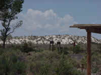 White
Sands NM. This picture is looking at some sand dunes from the VC. I
made my final reservations at Globe Arizona. I had stayed here before on
Easter weekend and liked the motel. I nice secluded parking lot and a good
Chinese buffet nearby. Plus following US-70 would be a nice change from
I-10.
It was just over 100 at the VC. I finally would try
out the sahara vest. I soaked the vest in the sink at the VC, and put it
on. It gains a few pounds as it holds water. So off I went. At
highway speeds, I was shivering in 100 degree heat. This effect only only lasted
for about 20 miles, and then it became pleasantly damp. It was great. I
didn't lose as much moisture this way, and my water consumption from the
Camelbak was down. I should have used this on the first day of the
trip. After 100 miles, I was looking for gas and to wet the vest again.
I took US-70 through Las Cruces, back onto I-10, and then
left I-10 on US-70 at Lordsburg, near the Arizona border. I-10 curves
south here, US-70 goes northwest. I enjoyed the 2-lane highway again, and
took US-70 all of the way to Globe, where it meets US-60 and ends (way back,
before the interstate highways, US-60 and US-70 shared the same path all of the
way to LA. I had already ridden on US-70 between Globe and Safford, so I
knew it was a good highway to travel on. In fact, this highway has a name,
The Old West Highway.
I made it to the motel at 5:30 MST. I had picked up
another hour as I crossed into Arizona since that state does not observe
daylight savings time. So I finally was on California time.
Map: 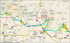
Back to Day 20
On to Day 22