Day 2 - The Dalles, OR to Bend, OR - 483 miles
Left the motel at 7:20, continuing east on I-84, up the Columbia Gorge.
Traffic was very light and the temperature was just right for cruising
along. Just as I-84 started pulling away from the river (and the Columbia
bends northward), I got off the superslab for some two lane highways. I
wouldn't hit much fourlane for the rest of today's journey. I was on
US-730, which follows the river as it bends northward. Soon I was back in
Washington, and the speed limit went up to 60. All of the non-Interstate
highways in Oregon are 55 max. I continued east on US-12 and arrived at  Whitman
Mission NHS, just outside of Walla Walla. Dr. Whitman was a Protestant
missionary who founded a mission there in 1836. It was on the Oregon
Trail, but the trail was rerouted in 1844. It came to a bloody end in 1847
when a measles empidemic hit the Cayuse Indians and some took out their anger on
the mission killing Whitman and his wife and 16 other inhabitants.
 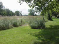 The
picture was taken on the grounds of an area that the NPS is trying to get the
natural prairie grass to grow again.
I bypassed Walla Walla by taking the small farm roads, zigzagging east and
south, crossing back into Oregon and following State Line road to OR-11. I
went southwest to Pendleton. I then took US-395 south out of
Pendleton. In Pilot Rock, I stopped to put the raincover on the bag.
Just in time, since I started hitting scattered drops as I went south. The
road wasn't wet, so I cranked up the throttle and motored along at a good pace, slowing
down for the curves. US-395 is fun here. It crosses several
east-west mountain ranges, but the turns are mostly nice sweepers. Several
straight valley running give you a break now and then. I stopped for gas
in Long Creek. The road was wetter there, a shower must have passed
through. A dry line was forming for the rest of the trip down 395 to US-26
at Mount Vernon. It was time to head west on US-26, stopping at the Sheep
Rock unit of the  John
Day Fossil Beds NM, along the John Day river. (John Day was an emmigrant
who got robbed by the Indians along the Columbia. Afterwards, steamboat
guides would point out the spot where John Day was robbed. The river that
flowed into the Columbia at that point became known to many as the John Day
River and the old name was forgotten.) The NPS is building a new VC and
museum. The current VC has been in an old farmhouse. The farmhouse
will become an exhibit on farming.
I continued west on US-26. It started lightly drizzling and the road
became wet, so I slowed the pace down a bit. It finally dried up near
Prineville. I reached US-97 in Redmond and turned south. US-97 is
rutted in places. It seems the volcanic ash that it is built on top of
settles, forming a set of ruts. If you ride in the center of the lane, it
is OK, but if you drift left or right, you slip into the ruts. Changing
lanes was interesting, to say the least. About 10 miles south of Bend, I
got to the 
 Newberry
National Volcanic Monument. This monument is administered by the Forest
Service, so my pass wasn't good there. I paid a few bucks to get in and
went to the visitors center. After getting my stamp, I took the road to
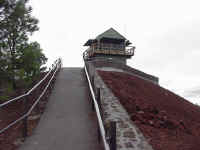
the top of Lava Butte which rises about 500 feet above the plain. The road
does about 1 1/2 circles of the butte. The forest service has had a
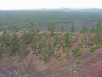
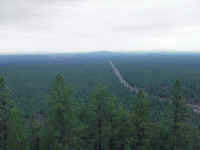
lookout on top of the butte for many years. The photos were taken
there. The first is of the lookout. The middle is looking west from
the lookout. And the picture on the right is looking north towards Bend
along US-97.
A quick hop back north on the highway brought me to the Super 8 in Bend where
I spent the night. As I was following a truck, I discovered that my low
beam was burned out. That bulb only lasted 7,000 miles. Checking the
instrument panel, I found that a couple of those tiny lights had also
blown. It seems that every time I lose the low beam, it takes some panel
lights out too. I ran on the high beam for the rest of the trip. I checked in at 17:00. I spent 7:49 on the bike,
averaging 61.7 mph for the day. 1,554 miles down so far on this
trip. I walked about 1 mile north to a BBQ Buffet that I saw
earlier. It was excellent. If a place like this was near me, I would
be there just about every night. I had some great porter made by the local
brewery. I even picked up a couple more bottles on my way back to the
motel and enjoyed them that evening.
Back to day 1
On to day
3