Day 3 - Bend, OR to Lake of the Pines, CA - 535 miles
I left the motel at 7:30. The sky was overcast, so I had put on the
waterproof liner. I'm glad I did, it was quite chilly this morning.
In Chemult, I got gas and also put on the triple-digit glove rain covers.
This helped warm me up because my fingers had been losing a lot of heat.
OR-138 runs nearly straight through the trees until it meets with the highway to
Crater Lake. The roads were wet here. I went south into Crater Lake
NP, turning right (counterclockwise) at the rim. The north Rim junction is
just over 7,000' in elevation. There still was snow in quite a number of
places, mostly in the shade or on north facing slopes. I dove into the clouds
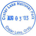
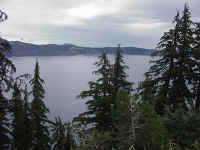
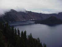
along the rim road. I stopped at Rim Village to get the stamp and take
these pictures of the lake.
I then headed south east out of the park towards Klamath Falls. The
roads were dry by the time I reached US-97 north of Klamath Falls. I
wouldn't hit any raindrops for the rest of the day, but I did hit some wet
roads. I took Or-39 and CA-139 to Tulelake and then some county roads to
Lava Beds NM. The roads here were great, some smoothly paved. I was
traveling at a brisk pace in many places. Lava Beds has some great lava tubes
(caves) to explore. I need to come back again some day. You can
check out flashlights at the VC. Otherwise, it was just more lava.
Starting with the previous afternoon, it was just one lava area after
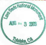
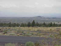
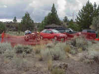
another. The photos below were taken at the VC. It looks like they
are building a new VC near the old one.
I originally was going to take a bit of gravel road and head towards CA-89 at
Bartle. But I was getting low on gas, so I went east out of the park, back
to CA-139, along CR-10. The road was a bit bumpy in places, but a quick
pace was still easy to maintain. There was some gas pumps near a sleepy
looking campground and store, but I decided to skip them in hopes of finding a
station with a higher volume of business. I turned onto Lookout road to
blast south to Bieber and CA-299. Finally I found gas at a station that
seemed to sell more than a few gallons a week. I was well into
reserve. I had near been able to pump more than 4.5 gallons into the tank,
but this time it took 4.9 gallons to fill it up. 220 miles on 4.9 gallons
(Chemult->Bieber). Since the clouds were starting to have some blue
patches showing, I removed the glove rain covers and put them away.
I went on to CA-89 for the trip into
 Lassen
Volcanic NP. The roads here are fun. 65-70mph and nice curves that
can be taken at speed, mixed with 45mph curves to keep you awake. The
entrance station required me to show my driver's license besides the parks
pass. Not sure why. It was a bitch to dig out the wallet. In
the NP, the speed limits dropped to 45 and 35. The high point in the road is at 8,500' in
elevation. There was quite a bit of snow in places. After the summit, the NPS is repaving the
road. The old asphalt was gone, so it was dirt which was quite wet in
places for the 5 miles of switchbacks down the hill to the southwest entrance
station. By the time I hit the pavement again, the bike looked more like
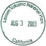
my dual sport, caked with mud. I almost missed the stamp! I had
passed the southwest information center, not realizing what it was and went out through
the entrance station. I did a quick u-turn back to the entrance and asked
the booth attendant where the stamp is. It turns out the stamps are at the
entrance booths. So I pulled over to park and walked back to the booth for
my stamp.
I made my way to CA-32 for the ride down out of the mountains to Chico.
Great road. Nice people in their cages pulled over, too. So it was a
ride that makes motorcycling nirvana. It was hot in Chico and no
clouds! I removed the cover from the bag and finally took of the dry-tech
liner. I made my way south along CA-70, through some great smelling peach
orchards. I went east back into the foothills to Grass Valley and then
south along CA-49 to my Dad's house at Lake of the Pines. I arrived at
18:30, after spending 9:24 on the bike for the day, averaging 56.8 mph.
2,088 miles covered so far. Dad and his wife took me out on the lake in
their boat for some wine and tortilla chips. We later ate dinner on the
patio.
Back to day
2
On to day 4